
Buying property or verifying land details in the picturesque Union Territory of Jammu & Kashmir used to mean endless trips to local municipal offices or waiting on local revenue officials. Fortunately, the digital age has swept through the region’s administrative corridors. Under the flagship Digital India Land Records Modernization Programme (DILRMP), the Government of Jammu & Kashmir launched the “Aapki Zameen Aapki Nigrani” (AZAN) initiative. This digitized system has put the power of property inspection directly into your hands.
Whether you are a retail property buyer checking spatial plot boundaries, a landowner verifying ownership, or a legal professional conducting deep-dive due diligence, J&K’s integrated digital portals provide round-the-clock, secure access to your land data.
In this comprehensive guide, we will walk you through everything you need to know about navigating the J&K Land Records Information System (LRIS), extracting critical certificates, understanding recent registration fees, and complying with the landmark December 2025 J&K Unified Building Bye-Laws (UBBL).
Understanding the J&K Land Records Information System (LRIS)
The J&K Land Records Information System (LRIS), hosted officially at landrecords.jk.gov.in, is a highly secure, multi-tiered, and scalable web application designed to act as a single-window decision-support system. Developed and maintained by the National Informatics Centre (NIC), the portal aims to establish complete transparency, eliminating the manual discretion that historically led to property disputes.
The LRIS allows public users, government agencies, and external stakeholders to query real-time data regarding property ownership, tenancy, and land usage.
The Tripartite Land Record System in J&K
To understand what you are viewing on the screen, you must first understand J&K’s historical land-indexing architecture. J&K utilizes a tripartite system to record land interests:
- Record of Rights (Misalhaquat): This is the baseline cadastral document prepared during a major land settlement survey. It lists ownership holdings, tenancy rights, land revenue, and map coordinates.
- Land Ownership Register (Jamabandi): This is the core ledger of title and land rights. Legally revised every four years under J&K’s traditional Chaharsala (four-year) cycle, the Jamabandi represents the current, legally binding status of ownership on the plot.
- Harvest Inspection Register (Girdawari): Conducted bi-annually directly on-site by a field revenue officer (Patwari), the Girdawari records physical cultivation, crop types, and tenancy status. While it does not establish ownership title, it is crucial for verifying who is actively occupying and using the land.
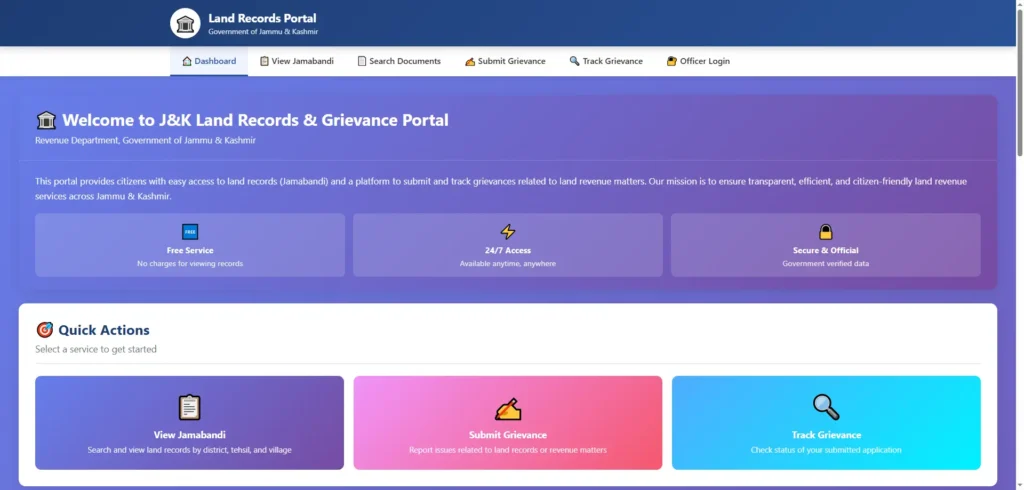
How to Check Jamabandi on the J&K Land Records Portal Online
Ready to search? The portal is designed to let public users search and view Jamabandi documents online. Follow this step-by-step guide to run a successful search.
Step 1: Registering as a Public User
- Head over to the official portal at
landrecords.jk.gov.in. - Click on the Public User tab on the homepage.
- Click on New Account / SignUp to create your user profile.
- Fill in the required fields: your full Name, Email Address, Mobile Number, and current residential address.
- Select your default target District, Tehsil, and Village.
- Submit the form, verify your email or mobile via OTP, and log in with your newly generated credentials.
Step 2: Searching Your Land Record
Once logged in, click on the Search Land Records module. To pull up your target property, you must filter your search through the official administrative hierarchy:
- Select your District (e.g., Jammu, Srinagar, Samba, Anantnag).
- Select the Tehsil and Village where the land parcel is physically situated.
- Select the Jamabandi Year (typically the latest completed settlement cycle).
Now, the system will offer you four distinct search parameters. Depending on the information you have at hand, you can search by:
- Khewat Number: The proprietary holding number that identifies a specific owner’s block of land.
- Khata Number: The tenancy or co-sharer ledger number under that specific Khewat.
- Khasra Number: The individual plot-level survey number assigned to that exact patch of land on the village map.
- Owner Name: Search by typing the owner’s name. Search Tip: Since legacy records are transcribed from Urdu and Dogri, spelling transliterations on the portal can sometimes vary. If your first search fails, try searching using partial names or alternative English spellings.
After selecting your query parameter, click Search. The portal will display the matching scanned revenue ledger pages, which you can read and verify on your screen.
Viewing Spatial Plot Boundaries via Bhu Naksha J&K
A common pitfall in real estate transactions is buying a plot based solely on written papers, only to find out later that the actual physical boundaries on the ground do not match the official map. This is where Bhu Naksha Jammu & Kashmir becomes your most valuable due-diligence asset.
How to Access Land Parcel Maps Online
The J&K Land Records portal integrates directly with spatial maps. To view these, you can click the View Map link inside the LRIS portal, or navigate directly to the state’s Geographical Information System (GIS) Portal at stategisportal.nic.in. This advanced spatial map viewer is powered by the National Informatics Centre (NIC) and built on top of India’s unified BharatMaps framework.
Here is how to extract and verify cadastral maps using Bhu Naksha:
Step 1: Navigating to the State GIS Portal
Launch the direct GIS Map Viewer (stategisportal.nic.in/stategisportal/Home/Map/1). The viewer is populated with highly detailed, multi-layered geographic information.
Step 2: Using ‘Universal Search’ to Enter Khasra or Khewat
Use the “Universal Search” bar on the map interface. Select your District, Tehsil, and Village, then enter the exact Khasra (plot) number or Khewat (holding) number you wish to inspect.
Step 3: Checking Plot Boundaries and Geotagged Lay-out
The map will instantly zoom to the geotagged parcel boundaries of your selected Khasra. Here, you can visually cross-verify the plot’s shape, check neighboring Khasra numbers, and verify if the land boundaries overlap with roads, forest areas, or state-owned land buffer zones.
Crucial Documents Needed for Due Diligence in J&K
When investing in J&K real estate, simply “viewing” land records on a screen is not enough. You must secure and verify specific legal and administrative documents to safeguard your investment.
Fard Intikhab (Certified Revenue Extract)
If you are applying for a home loan, agricultural financing, or drafting a final sale deed, the bank or sub-registrar will demand a Fard Intikhab.
- What is it? Issued under Rule 34 of the J&K Land Revenue Rules 1969, the Fard is a certified, official extract of the land’s revenue record. It contains the name of the owner, cultivator details, area measurements, land category, and pending encumbrances.
- The Approval Chain: The local Patwari prepares the Fard, the Girdawar physically verifies it, the Naib Tehsildar officially attests it, and the Tehsildar countersigns the document.
- The 30-Day Expiry Rule: A Fard Intikhab is strictly valid for only one month (30 days) from its date of issuance. This short window prevents sellers from hiding recent court freezes, private mortgage pledges, or pending mutations that might have occurred after the Fard was printed.
- Crucial Warning: Standard public-user printouts or “examination only” extracts obtained directly from the online LRIS portal do not carry legal weight for property transactions. You must obtain a digitally signed or physically countersigned Fard from the competent Tehsildar to execute a legal sale or mortgage.
J&K Domicile Certificate Rules for Land Purchase
Following major administrative reforms post-October 2020, J&K’s land-buying rules changed dramatically. Here is the exact legal standing regarding domicile requirements:
- Non-Agricultural Land: You do not need a J&K Domicile Certificate to purchase non-agricultural land (such as commercial plots, residential houses, or apartments in urban centers). Non-locals can legally purchase these properties directly.
- Agricultural Land: Buying agricultural land remains strictly restricted to J&K Domiciles. Non-agriculturists cannot buy agricultural land unless they secure explicit, special permission from the UT Government.
Non-Agricultural (NA) Conversion Order
If you have purchased land classified as agricultural and plan to build a home, warehouse, or commercial office on it, you must apply for land-use conversion.
- The Law: Under Section 133-A of the J&K Land Revenue Act, executing any construction on agricultural land without formal conversion is strictly illegal.
- The Issuer: The District Level Committee (DLC), chaired by the District Collector, scrutinizes and issues the written NA Conversion Order.
- Timeline: The DLC operates under a statutory timeline to approve or reject conversion applications within 30 days once all document deficiencies are cleared.
- The One-Year Lapse Rule: An NA Conversion Order is not permanent until construction begins. You must commence construction within exactly one year from the date of issuance of the conversion order. If construction does not begin, the order lapses, and the land reverts back to agricultural classification. A maximum extension of up to two years can be requested, subject to the Collector’s approval.
J&K Stamp Duty and Property Registration Charges (2026 Guidelines)
Once your due diligence is complete, the next step is executing the sale deed, paying stamp duty, and registering the property with the Department of Registration. J&K’s stamp duty framework is structured to encourage female ownership.
Current Stamp Duty Rates by Gender and Location
Stamp duty is calculated based on the market valuation of the property (notified annually via Circle Rates):
- Urban Areas:
- Male Buyers: 7% stamp duty.
- Female Buyers: 5% stamp duty (or 3% under specific joint categories in certain areas).
- Rural Areas:
- Male Buyers: 5% stamp duty.
- Female Buyers: 3% stamp duty.
- SRO Registration Fee:
- Regardless of location, gender, or joint ownership, a flat fee of 1.2% of the total property valuation applies as the registration fee to execute property deeds (such as sale deeds or exchange deeds).
National Generic Document Registration System (NGDRS) and Appointment Booking
To register property deeds, J&K utilizes the National Generic Document Registration System (NGDRS), a unified “One Nation, One Software” initiative designed by the Department of Land Resources.
- Valuation & Submission: Citizens can log in to the NGDRS J&K portal, calculate stamp duty online, enter document details, and upload draft deeds.
- e-Stamps & Booking: After purchasing e-stamps through authorized vendors, you can book a specific appointment slot at the office of your local Sub-Registrar Officer (SRO) to finalize the registration.
- Aadhaar e-KYC: On the day of your appointment, biometric or iris-based e-KYC authentication is conducted at the SRO office using advanced L1-compliant devices (such as Mantra scanners) to prevent identity fraud.
- The Mutation Gap: It is crucial to note that J&K is still in the process of linking registrations to automatic land mutations. Currently, only 18% of SRO offices (17 SROs located in Jammu and Srinagar districts) are fully integrated with the land records database to trigger an automatic digital mutation upon registration. In the remaining districts, you must still apply manually to the local Tehsildar to complete the mutation process after registration.
December 2025 J&K Unified Building Bye-Laws (UBBL) & Construction Permitting
On 1st December 2025, the Government of Jammu & Kashmir issued a highly significant gazette notification, replacing conventional physical processes with an advanced Online Building Permission System (OBPS). If you are constructing any building in municipal or development authority areas (such as Jammu Development Authority – JDA), complying with these revised rules is mandatory.
The Online Auto-Scrutiny System (OBPS)
The highlight of the Dec 2025 amendment is the introduction of Online Auto Scrutiny of Applications.
- What it does: When building plans and structural drawings are uploaded through the designated building permission portal, the auto-scrutiny system automatically checks them against Master Plan zoning, Unified Building Bye-Laws, and local Development Control Regulations.
- Parameters verified: The system automatically checks plot size, setbacks, ground coverage, Floor Area Ratio (FAR) / Floor Space Index (FSI), height restrictions, and parking layouts.
- RTP Supervision: All plans must be prepared, signed, and submitted by a registered professional listed as a Registered Technical Person (RTP) on the Housing & Urban Development Department (H&UDD) portal.
- Accelerated Clearances: Timelines for obtaining No-Objection Certificates (NOCs) from various line departments (like Fire, PDD, and Jal Shakti) have been streamlined. Clearances that historically dragged on for months have been capped at a strict 21-day timeline. If an agency fails to respond within 21 days, the system escalates the application.
Residential and Commercial Development Controls
The amended regulations replace standard development control guidelines with strict plot-to-road width tables.
For example, under Table No. 5-3 (Residential Regulations), large-scale residential plots are guided by specific parameters:
- Plot Area (2000 to 8000 sq.m): Max FAR is set at 300, minimum Right-of-Way (RoW) must be 9 meters, with a building line of 1/5th of RoW + 1/2 of the RoW. Minimum side setbacks of 3.0 meters are required on each side, with a minimum setback of 6.0 meters all around for buildings up to 40 meters in height.
Similarly, commercial complex guidelines are defined under the revised Table No. 5-4:
- Shopping Clusters / Commercial Complexes (Plot Area > 750 sq.m): Max FAR is set at 300, minimum RoW of 9 meters is required, with front setbacks conforming to 1/5th of the RoW, and side/rear setbacks kept at a minimum of 1/3rd of the total building height. Multi-level basements are allowed for parking but are excluded from the calculation of the FAR.
Green Building Norms, Energy Efficiency (ECSBC) and Additional FAR Incentives
In a bold move toward sustainability, J&K introduced a brand-new Chapter 15: Green Building Norms and Energy Efficiency in its Dec 2025 Bye-Laws.
- Applicability: These rules are mandatory for all new commercial buildings with a connected load of 100 kW or contract demand of 120 kVA or more, and all group housing or commercial complexes with a total built-up area greater than or equal to 2,000 sq.m.
- Design Standards: Buildings must comply with the Energy Conservation Settlement Building Code (ECSBC) climate zone standards, limit their Window-to-Wall Ratio (WWR) to 40%, use LED lighting in common areas, and install sub-meters for major energy-consuming systems.
- Incentive Matrix: Developers who voluntarily adopt certified green standards (GRIHA or IGBC ratings) are rewarded with additional free Floor Area Ratio (FAR) and substantial fee rebates:
| Green Rating Standard | Voluntary Certification Level | Additional Free FAR/FSI (%) | building Permit Fee Rebate | Annual Property Tax Rebate |
|---|---|---|---|---|
| GRIHA 3-Star / IGBC Silver | Entry-Level | +7% | 10% | Up to 5% |
| GRIHA 4-Star / IGBC Gold | High Performance | +10% | 15% | Up to 7% |
| GRIHA 5-Star / IGBC Platinum | Exceptional Standards | +15% (Cap) | 20% | Up to 8% |
For standalone residential buildings, achieving basic Eco-Niwas Samhita (ENS) envelope compliance grants up to 3% additional FAR and a 10% building permit fee rebate.
Tracking Mutations and Resolving Grievances
Once you buy land and register the sale deed, the transaction is not complete in the eyes of the government until the land mutation is attested.
Online Mutation (Dakhil Kharij) Status
- What is a Mutation? The Mutation (Dakhil Kharij) is the administrative process of updating ownership names in the official Record of Rights (Jamabandi).
- The Timeline: J&K operates under a strict 30-day statutory timeline to resolve and attest land record mutations.
- Dashboard Transparency: Real-time progress can be tracked on J&K’s Single Window Single-Instance Mutation Dashboard. Empirical operational data shows that the system has processed a massive volume of transactions:
| Service Category | Statutory Timeline | Total Applications Received | Total Applications Approved | Average Processing Time | Minimum Processing Time | State-Fixed Service Fee |
|---|---|---|---|---|---|---|
| Land Record mutations (inc. NGDRS) | 30 Days | 240,399 | 167,643 | 25 Days | 5 Days | INR 1,500 |
Checking the mutation status regularly ensures your name is officially recorded as the legal owner, protecting you against fraudulent double-sales by previous owners.
Filing Grievances for Errors
If you discover spelling mistakes in your name, incorrect Khasra allocations, or area mismatches in the scanned digital copies on the portal, you can register a grievance:
- Visit
jkzameensudhar.jk.gov.in(the designated land grievance portal). - Submit your application detailing the record mismatch, uploading copies of your physical sale deed and registered documents as evidence.
- The Tehsildar and Naib Tehsildar are mandated to review and resolve digital record disputes within 15 to 30 working days.
Frequently Asked Questions (FAQs)
Is there a fee to search and view JK land records online?
No. Viewing scanned land sheets, Jamabandi ledgers, and GIS Bhu Naksha maps is completely free on the official J&K LRIS and State GIS portals. However, obtaining certified, digitally signed copies for official court or banking transactions requires paying a nominal government processing fee.
What is the significance of Column 12 in the Jamabandi or Fard document?
Column 12 is arguably the most critical column for property buyers. It records pending mutations, bank mortgages, private land pledges, court stay orders, or state land recovery proceedings. Always check this column carefully—any entry written in red ink indicates a legal block or pending claim on the land.
Can I search J&K land records using only the owner’s name?
Yes, the LRIS portal allows name searches once you register a public account. However, because historical names are translated from regional Urdu/Dogri registries, you may need to try several phonetic variations of the name to locate the exact record. It is always recommended to search using the unique Khasra or Khewat number for 100% accuracy.
What happens if I build on agricultural land without an NA Conversion Order?
Constructing any permanent structure on agricultural land without an approved conversion order from the DLC is a serious legal violation under Section 133-A of the Land Revenue Act. Municipal or municipal-fringe development authorities have the power to halt construction, demolish illegal structures, and impose heavy penalties on the property owner.
How do the Dec 2025 building guidelines affect residential construction height?
Under J&K’s Dec 2025 building amendments, permissible height is strictly linked to road width (Right-of-Way) and plot setbacks. For large-scale residential projects, heights can go up to 40 meters and beyond, provided the plot maintains a minimum road width of 9 meters and setbacks are verified and cleared by the Online Building Permission System (OBPS) auto-scrutiny scanner.
Summary Disclaimer: The digital land record initiatives in Jammu & Kashmir are continuously evolving. While online verification is an excellent primary screening tool, buyers are strongly advised to physically verify land boundaries, examine the original physical mother deeds, and consult local legal counsel before executing financial transactions.